

Bannalp is one of these small quaint mountain top areas that offers the perfect combo of just about everything you can ask for when you hike in Switzerland.
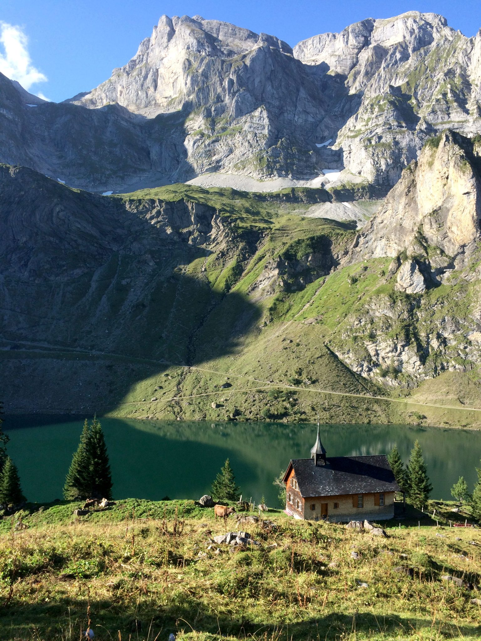
And when I say everything, I really mean super sick views! The photos above are what it looks like on a sunny day. The lake water is an amazing shade of glacier green.
This is a hidden gem, for me at least, because I have been living 15 minutes away for a total of over 5 years of my life (do I get a little break because they weren’t all consecutive?). You drive through one of my favorite enchanted swiss valleys on the way there, a short 7 minutes from the main highway connecting North and South. It is the route to Engleberg, a quintessentially-Swiss mountain village tucked into the alps. Oberrickenbach is even smaller and more authentic because its still a secret to tourist. Just before you start to make the climb in altitued and swerve around all those nausea inducing switchbacks, you take a left in Wolfenschiessen (translated as wolf shooting) and make the climb into the little tiny (farmer town) of Oberrickenbach. By the way on your way out, do not pass the Gasthaus Post Restaurant (Dorfstrasse 4 6387 Oberrickenbach) with out stopping for fondue. It really is the best place to share a pot of flavored cheese with a friend, or many!

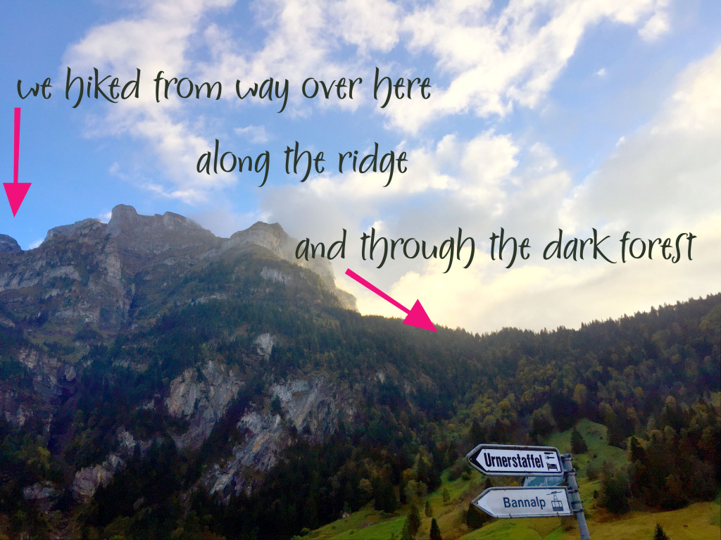
There are 3 gondolas up to the top of the cliff that forms a wall at the end of the valley, theres really no way to miss them because the road just ends. Take your pick of trails and decide which is a most strategic landing spot and then off you go. Warning: The gondolas up to Bannalp are private, translation: they do not offer a halbtax discount. I think its kind of expensive, but if you have a few hours to spend hiking take a one way and hike down- it saves a little money and is good for you!

A few weeks ago we picked one such route and promised a friend with kids who was going with us that this was a “gentle decent” and that her double knee replacement should be no worries. That was before we accidentally left the map at the bottom of the gondola station and decided we could figure it out. I had been there for a short hike before and there aren’t a whole lot of choices so I felt pretty confident.
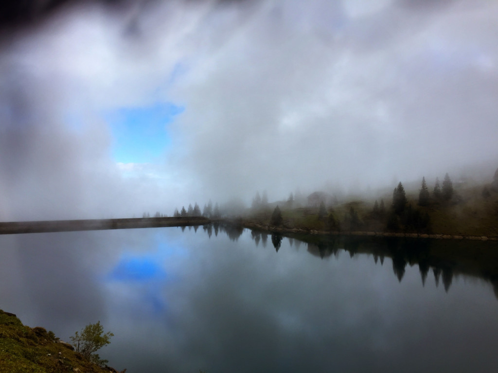
We did the circle around the lake for a warm up and took some beautiful photos of the moody clouds that were so inconsiderately blocking our views, when Sparticus serendipitously ran across a discarded map along the trail, and confidently proceeded to guide the way.
I wonder if you can tell where this story is headed yet? (Yes I blame him). We found our self headed down hill, as in a pretty steep downward mountain trail that was wet and extremely EXTREMELY muddy.
I have never seen a swiss trail in such bad shape. There were workers on it trying to make repairs while we struggled to stay upright and dry. There were a few times when I had to tell my self to “pick up those feet soldier” because I was going to sink in the mud if not, and more than once I felt like I was stepping out of my shoes that were cemented into the mud- squish squash squish squash.


The boys loved it and scampered ahead of us, occasionally slipping in the mud to see how dirty they could get. It didn’t take long (about 2 minutes in) for me to start voicing my concerns about the direction and our guide. He was not appreciative about this line of questioning and threw the map back in my direction landing in the wet mud. But determined- I fished it out and of course- I WAS RIGHT. We were not on the path we had planned and instead on a treacherous steep path that weaved around the shady side of the mountain range.
Too far gone, we pressed on, and on, and on. We were mostly happy little hikers because the weather was cool, and we had no rain and lots of friends to keep us entertained. AND THE VIEWS!!!


At least hiking through the shady muddy wet forest did provide for some moss love.

I have to make a few confessions, I have not been working out at the gym (or elsewhere ) in months. Work and home life are consuming. I was incredibly sore after that hike. I can not say that it’s only from being out of shape. I think that the trail was in such bad shape, my muscles must have had to compensate more than normal to just keep from sliding down the mountain. My friend who did the hike with us also complained about the pain for days after, thats my story and I am sticking to it!


No pain no gain. I will be back after snow season to check out the “right trail”.